

Preview
Creation Date
1-1-1999
Description
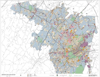
Produced by the Johnson City GIS Division on December 1, 1999, this map denotes the land use of Johnson City as of 1998. The key along the bottom edge identifies the types of land use via a color code. Major roads and highways are labeled on the map itself. Physical copy resides with Johnson City, Geographic Information Systems Division.
Scale - 3" = 6000’
Dimensions
34" x 44"
Rights
This map is being provided with permission of Johnson City GIS Division. As a Tennessee state depository library per T. C. A. § 12-6-107, Sherrod Library is providing free and open access to this map as part of our Tennessee Documents Collection. This map is for research and educational purposes only. Responsibility for interpretation and application of this map lies with the user. Sherrod Library makes no claim of copyright on this material. For additional use or rights of this map, please contact the GIS Division of Johnson City.
Keywords
land use, northeast tennesee, natural resources, map, southern appalachia
