

Preview
Creation Date
1-1976
Description
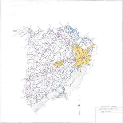
General highway map for Washington County, Tennessee revised January 1976 by Johnson City GIS in collaboration with the Tennessee State Planning Office. Major roads, highways and communities are included on the map. The Johnson City and Jonesborough city limits are denoted in yellow. Small communities are highlighted in purple. Highways are denoted in red. Physical copy resides with Johnson City, Geographic Information Systems Division.
Scale - 2" = 3 miles
Dimensions
19" x 18"
Rights
This map is being provided with permission of Johnson City GIS Division. As a Tennessee state depository library per T. C. A. § 12-6-107, Sherrod Library is providing free and open access to this map as part of our Tennessee Documents Collection. This map is for research and educational purposes only. Responsibility for interpretation and application of this map lies with the user. Sherrod Library makes no claim of copyright on this material. For additional use or rights of this map, please contact the GIS Division of Johnson City.
Keywords
Tennessee, highway map, historical map, rare map, Johnson City GIS
