

Preview
Creation Date
1976
Description
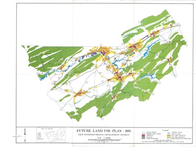
Originally published in 1976 and updated in 1995 by the First-Tennessee Virginia Development District this map showcases what future land use projections were for East Tennessee and Southwest Virginia at the time. Includes 9 counties which are listed on the bottom left of the map. Legend includes notations for existing and proposed highways as well as population density based on housing units per square mile.
Physical copy resides in the Government Information, Law and Maps Department of East Tennessee State University’s Sherrod Library.
Dimensions
23"x29"
Rights
As a Tennessee state depository library per T. C. A. § 12-6-107, Sherrod Library is providing free and open access to this map as part of our Tennessee Documents Collection. This map is for research and educational purposes only. Sherrod Library makes no claim of copyright on this material.
Keywords
Tennessee, Map, Land Use, Rare Map
