

Preview
Creation Date
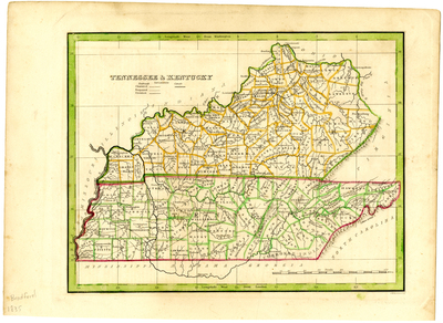
1835
Description
Scale 1 inch = 40 miles. Hand-colored map produced in 1835 by Thomas Gamaliel Bradford to show railroads, canals, counties and major cities. Reelfoot Lake is referred to as Wood Lake.
Dimensions
33 x 24 cm
Rights
The Archives of Appalachia at East Tennessee State University provides access to these materials for the purposes of research and education and is not aware of any U.S. copyright protection or any other restrictions for this item. Any commercial uses of the materials or any uses that exceed the limits of fair use and other relevant statutory exceptions may require the permission of any copyright holder(s). It is the user's obligation to determine and satisfy copyright or other use restrictions when publishing or otherwise distributing materials. Preferred citation: [identification of item], Archives of Appalachia, East Tennessee State University.
Keywords
Archives of Appalachia, rare map, Kentucky, Tennessee
