

Preview
Creation Date
12-4-1944
Description
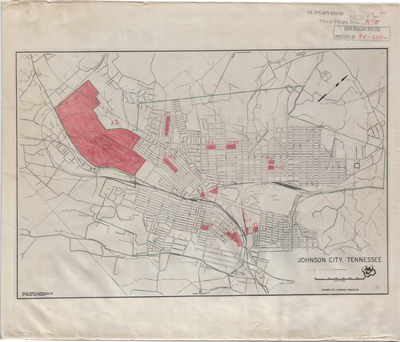
Indicates Johnson City city limits, and identifies with red pencil regions of the city labelled A1 through A12 along with A13R, A14R, and A15R. Johnson City Planning Commission. Base map prepared in February 1943 by the Tennessee State Planning Commission and the Tennessee Valley Authority. Supervisor: M.R.L.F. Map page no A-5. Preceded by 90-3101. Stamped July 1947. Scale 1 in = 1200 ft.
Dimensions
Retrieving data. Wait a few seconds and try to cut or copy again.
Rights
Retrieving data. Wait a few seconds and try to cut or copy again.
Keywords
Archives of Appalachia, rare map, Tennessee, Washington County, Johnson City
