

Preview
Creation Date
1978
Description
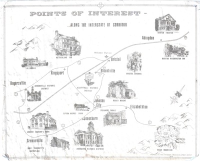
Preparted by the First Tennessee-Virginia Development District in 1978, this tourism map denotes points of interest along the I-81 corridor of Northeast Tennessee and Southwest Virginia. With I-81 constructed just 19 years earlier, this helped open the region up to many new travelers. This maps highlights some of the historic areas to visit, many of which still serve as area attractions today. These include Roan Mountain State park, Tipton-Haynes Farm and Davy Crockett's Birthplace. Also of note is the spelling of Jonesboro, which later reverted back to the original spelling of the town as Jonesborough.
Physical copy resides in the Government Information, Law and Maps Department of East Tennessee State University’s Sherrod Library.
Dimensions
19" x 23"
Rights
As a Tennessee state depository library per T. C. A. § 12-6-107, Sherrod Library is providing free and open access to this map as part of our Tennessee Documents Collection. This map is for research and educational purposes only. Sherrod Library makes no claim of copyright on this material.
Keywords
map, historic, tourism, northeast Tennessee, southwest virginia
