
Preview
Creation Date
1-1962
Description
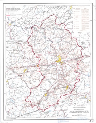
Soil Association map of the Upper French Broad River Watershed published in 1962 by the Tennessee Valley Authority, Division of Water Control Planning. Soil data supplied by Soils Department, North Carolina State College. Legend includes dominant soil type and descriptions, watershed divides, various types of roads, and other relevant information. Road names, mountains, communities, county lines, and other points of interest are also labeled on the map itself.
Physical copy resides in the Government Information, Law and Maps Department of East Tennessee State University’s Sherrod Library.
Scale: 2.5" = 10 miles
Dimensions
17.5" x 22"
Rights
As a Federal Depository per Title 44 U.S.C., Sherrod Library is providing free and open access to this map as part of our Federal Depository Collection. This map is for research and educational purposes only. Sherrod Library makes no claim of copyright on this material. It is the user's obligation to determine and satisfy copyright or other use restrictions when publishing or otherwise distributing materials.
Keywords
French Broad River, Soil Association Map, TVA, Watershed Map, Rare Map