

Preview
Creation Date
1969
Description
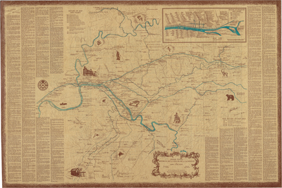
Indicates 414 events or locations of historic significance, and includes a legend summarizing their significance. For the Netherland Inn Association. Cartographer: H.T. Spoden. Illustrator: Bob Hensley. Copyright 1969 by H.T. and M.C. Spoden. Scale 1 in = 0.6 miles.
Dimensions
90 x 61 cm
Rights
The Archives of Appalachia at East Tennessee State University provides access to these materials for the purposes of research and education and is not aware of any U.S. copyright protection or any other restrictions for this item. Any commercial uses of the materials or any uses that exceed the limits of fair use and other relevant statutory exceptions may require the permission of any copyright holder(s). It is the user's obligation to determine and satisfy copyright or other use restrictions when publishing or otherwise distributing materials. Preferred citation: [identification of item], Archives of Appalachia, East Tennessee State University.
Keywords
Archives of Appalachia, rare map, Tennessee
