

Preview
Creation Date
1955
Description
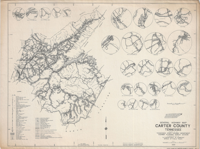
Scale 1 in = 2 miles. Prepared by the Tennnessee State Highway Department Highway Planning Survey Division in cooperation with the U.S. Department of Commerce Bureau of Public Roads. Highway map of Carter county with zoomed in areas of interest. Field data obtained un 1954 and field examination made in 1955. Includes a population census from 1950.
Dimensions
61 x 46 cm
Rights
The Archives of Appalachia at East Tennessee State University provides access to these materials for the purposes of research and education and is not aware of any U.S. copyright protection or any other restrictions for this item. Any commercial uses of the materials or any uses that exceed the limits of fair use and other relevant statutory exceptions may require the permission of any copyright holder(s). It is the user's obligation to determine and satisfy copyright or other use restrictions when publishing or otherwise distributing materials. Preferred citation: [identification of item], Archives of Appalachia, East Tennessee State University.
Keywords
Archives of Appalachia, rare map, Tennessee, Carter County
