

Preview
Creation Date
4-28-1964
Description
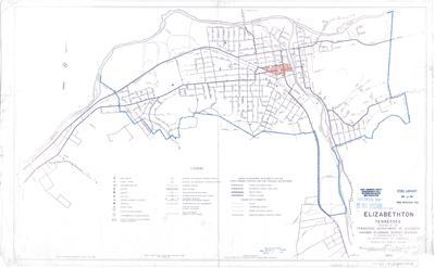
City map of Elizabethton, Tennessee prepared in April 1964 by the Tennessee Department of Highways Highway Planning Survey Division in cooperation with the U.S. Department of Commerce Bureau of Public Roads. The legend denotes a variety of points of interest within the city's infrastructure including government offices, hospitals, and highways as well as railroads and streams. The highlighted portions were added by hand at an indeterminate time post publication.
The ETSU Library Depository stamp is dated March 18, 1986. This is the date the map was received by the Government Information, Law and Maps Department where it resides as part of our Tennessee state depository collection.
Physical copy resides in the Government Information, Law and Maps Department of East Tennessee State University’s Sherrod Library.
Dimensions
23" x 37"
Rights
As a Tennessee state depository library per T. C. A. § 12-6-107, Sherrod Library is providing free and open access to this map as part of our Tennessee Documents Collection. This map is for research and educational purposes only. Sherrod Library makes no claim of copyright on this material.
Keywords
Elizabethton, Tennessee, City Map, Rare Map, City Planning
