
Preview
Creation Date
1985
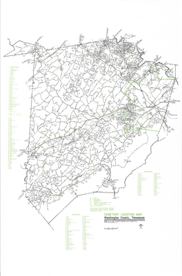
Description
Scale 1 in = 5000 ft. Prepared by the Upper East Tennessee Section, local planning assistance office in January 1985 and approved by the county commission of Washington County on February 4, 1985. County roadmap with cemetery locations (marked and unmarked) throughout the county.
Dimensions
64 x 97 cm
Rights
The Archives of Appalachia at East Tennessee State University provides access to these materials for the purposes of research and education and is not aware of any U.S. copyright protection or any other restrictions for this item. Any commercial uses of the materials or any uses that exceed the limits of fair use and other relevant statutory exceptions may require the permission of any copyright holder(s). It is the user's obligation to determine and satisfy copyright or other use restrictions when publishing or otherwise distributing materials. Preferred citation: [identification of item], Archives of Appalachia, East Tennessee State University.
Keywords
Archives of Appalachia, rare map, Tennessee, Washington County